About
Red Peak Resources is a Wyoming based Rocky Mountain region geosciences consultancy and prospect generator. Our company specializes in the exploration and development of natural resources, including crude oil, natural gases, and minerals. Red Peak Resources staff and associates bring exceptional ability, proven expertise, and a range of technical capabilities to provide systematic, integrated solutions to exploration and development problems.
AREAS OF EXPERTISE
- Regional exploration
- Prospect generation and assessment
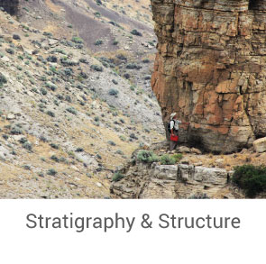
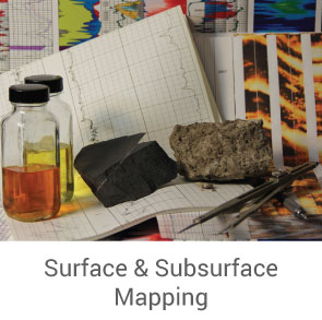
- Mapping – surface & subsurface
- Rock studies
- Reservoir characterization
- Resource & reserve estimation
- Property evaluation
- Expert geologic testimony
YEARS OF EXPERIENCE
We have a passion
for being innovative explorers.
Our Team
Based in the city of Casper, Wyoming, we are passionate, innovative explorers dedicated to helping our clients and partners be successful in the discovery, development and production of petroleum and mineral reserves.

TIMOTHY J. MCCUTCHEON
President/Member
Registered/Licensed Professional Geologist, Wyoming PG-919
Tim McCutcheon brings 39 years of varied experience in the natural resources industry. His scientific and technical areas of expertise include regional exploration, prospect generation and development, surface and subsurface geologic mapping, property assessment, resource and reserve evaluations, project management and economic analysis, reservoir characterization for IOR & EOR, petrography/petrology, petrophysics and general seismic data interpretation. Principle geographic areas of experience include the greater Rocky Mountain Region, Alaska, Basin & Range, and northern Great Plains of the United States, onshore Africa (mostly Algeria and Tunisia) and the central Asian Republic of Kazakhstan.
Tim has a Bachelor of Science degree in geology from the University of Minnesota – Duluth and a Masters of Science degree in geology/geophysics from the University of Texas – El Paso. Post-graduated studies include industry sponsored training courses and field seminars through the Rosenstiel School of Marine and Atmospheric Science, the University of Texas, and numerous other institutions. Tim is a Geological Society of America Fellow, active member of the American Association of Petroleum Geologists, and Society of Economic Geologists. He is a member and past president of the Wyoming Geological Association. From 1995 to 2005 he served as a member of the Potential Gas Committee, Colorado School of Mines. Tim has authored or coauthored a number of scientific papers and abstracts relating to petroleum geology, igneous petrology, and economic geology.

KAREN SUE MCCUTCHEON
Vice President/Member
Certified Geographic Information Systems (GIS) Specialist
FAA Part 107 Certified Remote Pilot
Karen Sue McCutcheon is an educator and for the past eight years has been a professional GIS Specialist and cartographer in the areas of geologic, surface/mineral estate data management and mapping. Her technical areas of expertise include GPS data gathering and data reduction, unmanned aerial systems data acquisition and mapping, computer-aided geo-reference and geospatial data analysis, integration of satellite/aerial imagery and other data to build databases and graphics for the natural resources industry. Karen Sue is an adjunct instructor for the earth science program at Casper College.
Karen Sue has a Bachelor of Arts degree in Elementary Education from Kearney State College, Nebraska and a Masters of Education from Colorado State University, Colorado. She is a National Board Certified Teacher and recipient of the Presidential Award for excellence in Mathematics and Science Teaching. Karen Sue received her GIS Specialist Certification from Casper College, Wyoming and has completed additional training and education through ERSI, Stanford University, California, and LMKR GeoGraphix. She is a member of WyGEO and from 2013-2014 served as the GIS representative on the Wyoming Geographic Alliance Steering Committee.
Creative visualization
anchored in science and technology.
Professional Services
Our company provides clients with access to cost effective integrated geoscience knowledge and technology solutions.
- All


Dedication to principles of scientific inquiry.
Toolkits & Databases
Integrated GIS and data analysis systems
- GeoGraphix Discovery Suite ™ V2019.3 GIS mapping and geospatial data management and query, well-log correlation, structural and stratigraphic analysis, petrophysics, and 2D/3D seismic interpretation.
- ERSI ArcGIS Pro data analytics, cartography and visualization.
- PHDWin 10.4 (V3 beta coming soon), integrated economics and decline curve analysis for evaluation of projects, producing properties and reserve evaluations.
- NeuraLog 2020 well-log digital curve tracing and data formatting and editing software.
- All Topos – Wyoming topo maps
Microscopy
- Zeiss Axio Scope.A1 polarized light microscope with Axiocam 208 imager and ZEN Core V2.7 imaging, analysis, database, and reporting software.
- Meiji Techno America EMZ 13TR binocular microscope with imager and image processing software.
Field Mapping
- DJI Phantom 4 Pro UAV with 20MP visible light sensor, surveying software, and Drone2Map image processing software. Integrated with GeoGraphix and ERSI ArcGIS Pro.
- Traditional standard tools (Garmon GPS, Brunton Geo pocket transit compass, Jacob’s Staff, map board, hammer, etc.)
Databases
- Historical archives (ca. 1916 – 2019), non-restricted proprietary geologic and engineering reports, maps, cross-sections, and other information relating to regional geology, prospects, oil & gas wells, and producing properties.
- Proprietary digital well-log database (~54,000 wells, depth registered images & selected digitized), internal QC, company owned.
- Historical well-log archives, ca. ~1908-1980’s drillers/geologist sample, USGS, hardcopy geophysical logs (~ 189,000 wells 1938-1992).